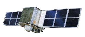
China launched it's Feng Yun 1B weather satellite in September 1990. It is in a sunsynchronous polar orbit with an altitude of 830 km. The satellite has four sensors in the visible light band and one in the infrared band. The highest resolution is about 1 km. Each image covers an area about 1,600 km wide (eastwest) and 3,200 km long (northsouth). It continuously transmits data in analog format for Automatic Picture Transmission (APT)and in digital format for High Resolution Picture Transmission (HRPT). These signal formats are compatible with U.S. Tiros satellites, therefore, receivers capable of receiving TIROS data can also receive Feng Yun data.