Remote Sensing and Fire Protection
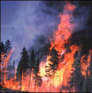
Wildland fires can be the cause of many different changes in the environment. They have a significant effect on forest ecosystems, and they can be extremely harmful to people who live, work and play in wildland areas. Remote Sensing gives us an opportunity to investigate wildland fires and begin to better understand their influence on the environment.
References and Further Information
Below are links to information concerning the satellite programs and sensors used in remote sensing, and some of their uses in the field of Fire Protection. These sensors allow for detailed evaluation of wildland fires, and the data and information gathered through remote sensing enables researchers and those working in fire protection to see patterns of development of fires throughout a wildland area. In some cases the data is in near real time. These sensors are also useful in gathering information concerning vegetation growth which helps with fire fuel mapping and seeing changes in the biodiversity of an area.
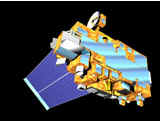
Image of Terra Satellite from NASA
Here are links to projects being done in Fire Protection by various organizations where Remotely Sensed Data is used.
Fire
M3 Project, Fire Monitoring, Mapping and Modeling
Mapping
Forest Fire Hazards (Rutgers University)
Pyrogeography
Research Laboratory (University of Arizona)
Detecting Changes in Forest Condition Using Image Processing and GIS
Wildland Fire Photos - This is a link to www.wildlandfire.com and their photo gallery. There are some great photos of wildland fires and fire fighters in action.
Satellite Images - This is a link to the visible earth site at nasa. There is an image archive that is divided up by sensor if you know what you are looking for.
Image Gallery - Here are a few images that of wildland fires capture by various sensors.
References and Further Information
Below are the sites that were used as sources of information for the creation of this page.
Fire Protection Information
Federal
Emergency Manag
Wildland Fire Operations Research Centre - This site provides information in the field of fire research, and fire protection. It includes current projects that use remote sensing and other field related topics.
WILDLANDFIRE.COM - This site is a great source of information. It includes wildland fire news, photos, books, and even jobs.
SMOKEJUMPERS - Click on this link and visit the National Smokejumpers Association.
Remote Sensing Information
NASA - This links will bring you to the Jet Propulsion Lab. A great place for info about remote sensing and satellite images.
NOAA - The National Oceanic and Atmospheric Administration - Their website provides a wealth of information on a variety of environmental topics.
Landsat Program - Landsat program page for more information about the Landsat Program.
SPOT - For more information about SPOT visit www.spot.com the SPOT homepage.
This page was created by a Salem State College Student of Remote Sensing from Massachusetts as a course requirement. Page created in May of 2001.
Background image from WILDLANDFIRE.COM
|
[ Imaging Earth Home Page | Dr. Young's Home Page | Department of Geography | Salem State College ] |