Satellites of the HYDROSPHERE
| SeaStar | ERS- | Radarsat |
| Marine Observation Satellite-1 (MOS-1) | |
Tropical Rainfall Measurement Mission (TRMM) |
![]()
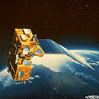
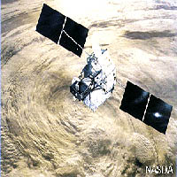
SeaStar
Applications: The principal objective is to acquire data that are critical for the study of the role of oceans, including the exchange of critical elements and gases between the atmosphere and ocean, and how these exchanges affect phytoplankton production. Data is also used to monitor sedimentation levels in the oceans and assessing the health of land-based vegetation on a global basis.
Sensor Description:
| Instrument Bands | Mission Characteristics | |||
| Band | Wavelength | Orbit Type | Sun Synchronous at 705 km | |
| 1 | 402-422 nm | Equator Crossing | Noon +20 min, descending | |
| 2 | 433-453 nm | Orbital Period | 99 minutes | |
| 3 | 480-500 nm | Swath Width | 2,801 km LAC/HRPT (58.3 degrees) | |
| 4 | 500-520 nm | Swath Width | 1,502 km GAC (45 degrees) | |
| 5 | 545-565 nm | Spatial Resolution | 1.1 km LAC, 4.5 km GAC | |
| 6 | 660-680 nm | Real-Time Data Rate | 665 kbps | |
| 7 | 745-785 nm | Revisit Time | 1 day | |
| 8 | 845-885 nm | Digitization | 10 bits | |
Table from SeaWifs Project Information Page
Data Format and Availability: SeaWifs data is in Hierarchical Data Format (HDF) and is available from Orbimage for non-research purposes. Orbimage refers to the SeaWifs data as OrbView-2 data. For purposes defined as "research" data is available freely to registered users to become an authorized SeaWifs user click here. If you are already an authorized SeaWifs user data can be obtained from the Goddard Distributed Active Archive Center (DAAC).
Notes: To process much of the SeaWifs Data the SeaWifs Data Analysis System (SeaDAS) is required software. To obtain the software click here.
ERS-Scatterometer
Applications: The ERS Scatterometer is a Radar platform that has in the past been used primarily for the monitoring of soil moisture content. One other application is the use of Scatterometer data in the determination of freeze/thawing cycles in the permafrost region of northern Canada. Being a Radar platform the ERS Scatterometer is not limited to such applications it's uses have only been marginally explored. Radar data of this type can also be used to measure atmospheric and vegetative moisture content. ERS Scatterometer has the distinction of being the only operational source of global sea-surface wind speed and direction.
Sensor Description:
| Instrument Bands | |
| Radar C-Band | 5.3 Ghz |
| Mission Characteristics | |
| Swath Width | 200km X 500km |
| Spatial Resolution | 50km |
| Revisit Time | 4-8/month |
Data Format and Availability: Images can be obtained from the European Space Agency or it's registered dealers (also available on this page) Data from a dealer will come with an associated cost but free low bit rate fast delivery (LBR-FD) product is available directly from the ESA. Transferring and reading this data requires special software that the ESA provides here.
Notes: The successor of the ERS Scatterometer, the Advanced Scatterometer which will be launched on the METOP satellite in the year 2002 or 2003, will have a spatial resolution of about 25 km, and will achieve global coverage every two days.” Images can be obtained at the European Space Agency (ESA) site and in most cases are provided free of charge.
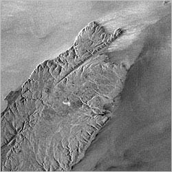
Radarsat
Applications: Current projects utilizing Radarsat imagery include the monitoring of glacier motion, watershed geology in Jordan, snow mapping, agricultural monitoring, forestland management, ice type identification, geologic mapping and flood monitoring.
Sensor Description:
|
Instrument Bands |
|
| Radar C-Band | 5.3ghz |
|
Mission Characteristics |
|
| Orbit type | Sun-synchronous polar |
| Swath Width | 35km - 500km |
| Spatial Resolution | 10m - 100m |
| Revist Time | 24 days |
Data Format and Availability: Data are offered in several formats to suit user needs. These include Computer Compatible Tape (CCT), films, print, and Image Transfer Network (ITN). CD-ROM, 8 mm tape cartidges and WORM drives will be available as they become industry standards. Data is available from a private agency called Radarsat International inc. Incorporated in 1989 specifically to collect and market Radarsat data this represents one source for Radarsat data at a cost.. However there is a sale going on right now.. (03-28-01). Data can also be ordered directly from the Canadian Centre for Remote Sensing (CCRS).
Notes: The CCRS is planning on launching Radarsat 2 in 2003 which will have higher temporal resolution.
Marine Observation Satellite-1 (MOS-1)
Marine Observation Satellite-1(MOS-1), "Momo-1" is the Japan's first Earth Observation Satellite developed applying domestic technologies as a part of Satellite Earth Observation Systems for contributing to effective utilization of Earth resources, environmental protection, etc. MOS-series satellites revolve the Earth at an altitude of 909 km in 103 minutes always facing their observation equipment to the Earth. Each of them carries three sensors, Multispectral Electronic Self-Scanning Radiometer(MESSR), Visible and Thermal Infrared Radiometer(VTIR), and Microwave Scanning Radiometer(MSR), their observation data are acquired by overseas ground stations as well as our domestic data acquisition stations and utilized extensively.
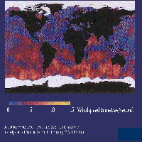
TRMM (Tropical Rainfall Measurement Mission)
Applications: "...dedicated to quantitatively measuring tropical and subtropical rainfall which is one of the most important and least-known parameters affecting the global climate system."
Data Access: Free downloads available to registered
users at
Links To Earth Imaging Agencies

Last modified: March-2001
|
[ Imaging Earth Home Page | Atmosphere | Biosphere | Hydrosphere | Lithosphere | Remote Sensing Bookmarks | Dr. Young's Home Page | Department of Geography | Salem State College ] |