Dr. Young's Home Page Marco or Micro Exhibit Earth Exposed Exhibit Australia From Space Exhibit
Satellite imaging provides us
with a very unique way to study and appreciate the Earth. I
use this imagery to visually attract the viewer, and hopefully, arose some
curiosity about the Earth and the imagery itself.
As a professional geographer I have been working with satellite imagery
for well over a decade. I have been
using it to understand how the Earth’s environment has been changing, with an
emphasis on vegetation change. While
doing my research I would often come across truly awe-inspiring images of the
Earth. I would take those images,
analyze them and turn them into a table on deforestation or hectares of biomass.
Eventually I started to save some of the images and I would hang them on
my office wall, or in the hallway. The
excitement these images created in my students made me realize the power they
have to illustrate basic concepts in Earth science and geography.
In 1998 I moved from school hallways to art galleries where I have been
working on the visual power of the imagery, the power to catch the viewer’s
eye and elicit a sense of wonder and curiosity about the Earth.
Now through the project, The
Earth Exposed, I am able to combine my love of academics and teaching
with my love of the visual arts, where beauty can help us appreciate and develop
an inquisitiveness about the Earth. On one level I create and alter the images to reveal the
beauty of the Earth while on another level, each of the images has a scientific
or geographic story to tell. If the
viewer develops a sense of curiosity, I have some additional information to help
them pursue that interest. I was
particularly excited about the National Science Foundation funded exhibit at the community-based Klein Gallery.
Along with the TERC Center for Earth and Space Science Education the
Gallery brought in Middle School students from different parts of Philadelphia
for an Art-Earth Science-Geography education program created by TERC, which is
based on the imagery in the Gallery.
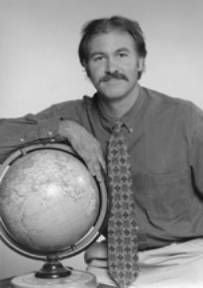
Dr.
Stephen Young is a professor of remote sensing and environmental sustainability
in the Geography Department
at Salem State University. Concerning
his work in global change, he has recently co-edited two books with geography
professor Steven Silvern (Global Environmental Change
and Sustainability, 2013 and International Perspectives
on Global Environmental Change, 2012). With a Canadian colleague he co-edited a
special edition of the journal Northeastern Geographer (Environmental Change in
Northeastern North America, 2012), co-wrote a paper: “Analysis of Land Surface
Temperature Change for Northeastern North America using MODIS Thermal data, 2001
to 2011” (Northeastern Geographer,
2012), and wrote a technical chapter “Geoinformatics and the Mapping of Lands Vulnerable to Sea Level
Rise” in the book Geoinformatics for Climate Change Studies, 2011. His Sea-Level
Rise Map of Salem Massachusetts was published in the Salem
News in June, 2014. Most recently he has published an article in Conservation
Biology on deforestation and forest protection in China
(2015) and another forest conservation paper concerning the
Eastern Himalayas in Biological
Conservation.
He received his Ph.D. in Geography from Clark University, a Masters in
Environmental Science from Yale University and a B.A. in Environmental Studies
form the University of Vermont.
S. Young’s e-mail address: syoung@salemstate.edu