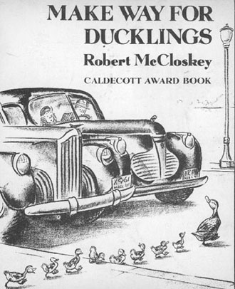
Make Way For Ducklings: A Bird’s Eyeview of Geography
An Elementary School Geography Lesson Plan
Overview
This lesson provides a fun way for students to learn some very basic, though essential, geographic principals such as scale, map reading, land-use analysis, and air photo interpretation. By using the classic children's story, Make Way For Ducklings, we transform the students into ducks, allowing them to view Boston from a very different perspective. This lesson uses a satellite image along with a series of air photos of Boston to give the students a duck’s perspective of the earth. Some of the greatest tools which geographers now have are satellites and air photos that provide us the ability to view the earth from above, much as a duck would. This lesson will introduce basic geographic skills in association with the Make Way For Ducklings’ story line. The lessons are simple and clear, attainable for all levels of elementary students depending on how in depth you wish to present the material. Each section also has an enrichment portion where more complex tasks can be undertaken. Although this lesson focuses on Boston, it is really only a jumping off point, as there are now satellite images and air photos available to the public for the entire United States, and therefore, you can adopt the plan for your local area as well. So, lets put on our wings and fly over Boston in search of a place to raise our young and learn about Geography!Grade Level / Time/ Materials
Grade level: Elementary grades 1 - 5Time Require: 2 days to 2 weeks or more (depending on the number of options used)
Materials:
- Pencils, Colored Pencils or Crayons, Rulers, Tracing Paper (Polaroid camera or any
camera);
- Satellite image from this web page;
- The three air photos from this web page;
- The Boston map from this web page;
- The book Make Way For Ducklings;
- Any support material about ducks, Boston, air photos, and satellite images.
Objectives / Skills / Themes
Objectives: This lesson is designed to:- Introduce the students to the "aerial perspective," i.e. seeing things from above;
- Introduce to the students the idea of scale, and how scale changes;
- Introduce maps to students;
- Introduce to the students the techniques of reading a map;
- Introduce the idea of land-use;
- Introduce satellite images and air photos to students;
- Introduce the concepts of reading and interpreting air photos;
- Discuss what type of environment animals need to live in (habitat);
- Discuss the type of environment humans live in;
- Make the study of Geography a fun activity!
Skills:
- Reading maps;
- Interpreting air photos and satellite images;
- Analyzing air photos with different scales of data;
- Classifying land use on maps and air photos;
- Analyzing the needs of animals;
- Analyzing how we structure cities;
- Working in groups;
- Developing stories and story telling;
Themes / Key Ideas / Vocabulary:
Scale, Representative Fraction, Aerial Perspective, Land Use Analysis, Animal Habitat, Map
Reading, Air Photo Interpretation.
Background
This lesson is divided into five sections that are related to each other and follow in a
logical order. The lesson plan begins by reading the book Make Way For Ducklings
and discussing the book and what happens in it. Here students gain an understanding about
ducks and their needs for living (habitat). They also learn about the interactions between
animals and humans. In the enrichment section the students can learn more about ducks and
their needs. Next, the students are asked to imagine being the ducks and they search for a
place to live in Boston. Here the satellite image and air photos are introduced and the
students are asked to follow the story using these images. In this section they learn to
interpret satellite images and air photos. They are also introduced to the "aerial
perspective." In the enrichment section students learn about land use mapping in the
city. Next, we introduce a map and compare it to the air photos and we discuss what maps
are and how to read the maps. We also compare maps to air photos and in an enrichment
section we make our own maps as well as go to the internet for further information. We
then introduce the concept of scale, one of the most basic, yet more difficult concepts in
geography. Here the students discuss the different things they see with different scales
of air photos. The enrichment section allows the students to determine scale. Finally, the
students are asked to search for other areas in Boston using the air photos and to come up
with their own stories about the adventures of the Boston ducklings.
Return to Top
Part A: The Story Line
The story Make Way For Ducklings needs to be read. Depending on the size of the class, the grade level, and teaching style, the story could be read to the whole class in one sitting, or the class could be divided into various groups with each group reading the story. Regardless of the style of reading, the following discussion questions should be addressed.
1. Why did the ducks end up coming to Boston?
2. How did they get there?
3. What are some of their concerns when raising a family?
4. What do ducks need when they are looking for a place to live?
5. List the different places where they looked for a place to live and describe the
positive and negative aspects about each place.
6. What kinds of interactions were there between people and the ducks?
7. Have you ever interacted with ducks?
8. What are some of the incompatible activities between people in a city and ducks?
9. What did the ducks like about the city and what did they not like?
10. What do ducks have to do to raise their ducklings?
11. What did Mrs. Mallard teach her ducklings?
12. What difficulties did Mrs. Mallard and the ducklings have in going back to the Public
Garden?
13. How did they get to the Public Gardens?
14. Why do you think the ducks decided to stay in the Public Gardens and not go back to
the island in the Charles River?
15. Have you ever been to Boston and seen the Public Gardens where the Mallard family
ended up living?
This activity should lead to a variety of discussions, especially about the needs of ducks. Any additional material about ducks and ducklings would be useful. A variety of activities can stem from here.
Enrichment: The
life of ducks
At this point you may want the students to do some more research about ducks. Some issues
which you might want to research are what ducks eat, who their enemies are (predators),
where they tend to live, when they generally lay their eggs, and how they raise their
young. If possible you might want to do some specific research on Mallard ducks and on
ducks in your area if they are different from Mallards.
Return to Top
Part B:
Seeing Like A Duck
Now we will use the satellite image and associated air photos. This section can be used
with the whole class, or in groups. It would be nice to break the class into different
groups and have them work with the air photos and later report back to the class as a
whole. If you break into groups you can supply the images from this web page for each of
the groups.
1. Satellite Image
This is a satellite image of Boston and surroundings taken from the Landsat satellite some
700 km above the earth’s surface. Green areas are vegetation, silver areas are urban
and blue - to - black areas are water.
Have the students look at this image and try to find Boston. If necessary, use an atlas to
help locate Boston. If your school is in the Boston area, can you locate where you are?
Have the students study the image. How many different kinds of things can they find, like
roads, airports, lakes, rivers, ocean, forests, etc. Have the students create a route into
Boston which the Mallards might have taken. Have the students find a couple of places
along the way where Mr. Mallard might have suggested they stop. What about these places
might be good for ducks?
2. Air Photo Number 1
Have the students look at this small scale (i.e. you can see a large area but not
with great detail) air photo of downtown Boston.
Ask them now to identify as many things as they can: rivers, roads, etc. If you have a map
of Boston, or an atlas with a Boston City map you might want to use that also. After they
have looked at the photos and identified a few things, have them identify the following
specific areas:
a. The Charles River, which is the prominent river in the image.
b. The two bridges at the widest part of the Charles River. The one closest to the top of
the image is the Longfellow Bridge and the other is the Mass Ave Bridge (also known as the
Harvard Bridge).
c. Piers along the Bay side of the city.
d. Have them locate the tall buildings in downtown Boston.
e. Find the Public Garden and the Boston Common (They are located between the tall
buildings and the wide part of the river).
f. For the places which they are able to identify in the air photo, can they also see them
in the smaller scale satellite image? It is often hard to, why? (Not as much detail in the
satellite image. The larger the scale the greater the detail can be found, but not as much
area is seen.)
3. Air Photo Number 2 Once
the students have finished reviewing air photo number 1, look at photo number 2 which is a
larger scale photo (i.e. can see more detail).
Now have the students locate themselves by finding the wide part of the river, the tall
buildings, and the Public Garden and the Boston Common. The Public Gardens have a large
pond in the middle and they are below the Commons.
a. How does air photo 2 differ from air photo 1?
b. Have the students pretend that they are the ducks and are flying around Boston.
- Why does the Public Garden look so good to a duck?
- In this photo are there any other potential places for a duck? Why? (In the lower right
one can find the Fenway where there are trees, shrubs and grass as well as water. Near
here you can see a baseball stadium. This is Fenway Stadium where the Red Sox play
baseball.)
-Any potentially dangerous places for a duck? Why?
4. Air Photo Number 3 This
is the largest scale photo. Now have the students locate the Public Gardens. Then ask them
to:
- Find the pond in the Gardens.
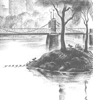
- Find the island in the pond where they think the ducks rested.
- Find the different paths that crisscross the Gardens. Ask the students to find the path
that they think the boy rode his bike quickly by the ducks. (May also lead to discussion
of people and animals sharing the same space on earth).
- Find an island in the Charles river near the Longfellow bridge where the ducks flew to
in order to raise their young. What do the students think the white specks are near the
island? (Sail boats) (Also note the bright white building near the islands. This is the
"Hatch Shell" where the Boston Pops play.)
- Why might this island be a good place for the Mallards to raise their young?
- Looking at the air photos, do the students think that this may be how ducks see Boston
when they are flying? Have any of the students ever flown in an airplane before and looked
out the window?
Enrichment: Land
Cover of Boston
Here the students will create their own map from the air photos. Use Air photo #2, tracing
paper, and colored pencils. With the tracing paper over the air photo have the students
trace (delineate) the following land-cover classifications:
- Tall building areas;
- Small building areas;
- Open space, parks; and
- Transportation corridors (highways, main roads, bridges, do not need to mark off small
roads).
The students can be as detailed or general as you (they) want.
Use the colored pencils to color in the different land-use classifications.
Have the students compare their maps and explain why they classified their areas the way
they did. What does this map tell us about the city of Boston?
Now use air photo # 3 (the largest scale photo) and do the same. Which air photo was
easier to classify, #2 or #3? How is the map from air photo #3 different from that of air
photo #2?
Return to Top
Part C: Maps
Download copies of the two Boston maps (large & small scales) from the web page.
Ask the students the following questions:
- How does a map differ from an air photo? (Maps have words, symbols, color / tonal
changes, etc. while photos show the actual buildings, parks etc.)
- How are they similar?
Now read the section on how Mrs. Mallard brings her ducklings back to the Public
Garden. Ask the students the following questions:
- Using air photo #3 how do you think the ducks got back to the Public Garden?
- Using the large scale Boston Map, can you find the street names and find the path that
they did take?
- Now that you know the route, can you find it on air photo #3?
- Can you find the highway that they had to cross?
- Do you think that this would be difficult for ducks to cross?
- Try air photo #1 can you find the route?
- Using air photo #3 and the Boston map, find a different route that the ducks could have
taken to the park.
Enrichment: Making a Map
Many maps are actually made from air photos. Using air photo #3 and tracing paper have the
students make a road map of the streets and a path map of the paths in the park. Then use
the Boston map to find out the street names, and the students can make up names for the
paths in the park. How do the student maps compare with the Boston Map?
Using the Internet. There are many programs on the
Internet to create maps and to display maps. Go to Yahoo’s mapping program (on the
Yahoo! Home Page click on maps, or go to the address: http://maps.yahoo.com). Pull up a
map of Boston in the Public Garden area by typing in the address: 100 Mount Vernon
Street, Boston, MA. You can then print the map. What are the differences between this
map and the Boston map in the Lesson? What are the differences between this map and the
maps that the students made? How is it different from the air photo? This illustrates that
there are many ways to make maps!
Return to Top
Part D: Scale
Scale refers to the distance on a map (or air photo) to the real distance on the ground.
It is often referred to as map distance - to - ground distance. For example, a map which
has a scale of 1 inch equals one mile, means that one inch on the map equals one mile on
the ground. In this way we can use maps to find distances. This actually is one of the key
elements of maps, and one of the key concepts in Geography. There are three major ways to
describe scale: 1) word phrases such as "one inch equals one mile;" 2) Bar
graphs where a bar on the map shows distances such as 1 mile, 2 miles, etc., and you make
a map measurement and then put that measurement next to the bar to see the ground
distance; 3) Representative fraction where a fraction depicts map distance - to - ground
distance such as 1:10,000. This means that 1 inch on the map equals 10,000 inches on the
ground. This is a very common map scale. It is called a unitless scale because you can use
any unit, i.e. one inch equals 10,000 inches or 1 centimeter equals 10,000 centimeters.
Scale is also referred to as Large Scale and Small Scale, and is a relative term. That is, air photo #3 is a large scale air photo relative to air photo #1. In large scale photos things look large while in small scale photos things look small. On the flip side, although in small scale photos things look small, you can see more area. This is why in small scale photos, or maps, we can see all of Boston while only the downtown in a large scale map. The three air photos can be considered as follows Air photo #1 is a small scale photo while air photos #2 and 3 are larger scale photos.
Which kind of scale is it?
Ask the students to look at the three different air photos and ask them to make a list of
the differences between the three of them. Such things as which are easier to see
buildings, which are easier to see more area, etc. In what cases would you use the
different photos? When do you want a large scale photo and a small scale photo.
Measuring distances on a map?
The large-scale Boston Map (Boston-2) in this lesson has a scale of (1:14,200). Using the
Boston map in this lesson, have the students use a ruler and measure the distance which
Mrs. Mallard and her ducklings had to walk to get to the Public Garden's pond from their
island in the Charles River. Here students learn about measuring with a ruler, as well as
counting and adding. Once you have the total map distance you multiply it by the scale and
you get the actual ground distance. For example, if the map distance is 20 cm, then we
multiply 20 times 14,200 = 284,000 cm or 2,840 meters (100 cm = 1 meter). You can do the
same in the English system (inches and feet) we just prefer the metric system because it
is so much easier to understand and use. Then have the students measure the distance
directly from the island to the pond, as if a duck was to fly it. Which is shorter and
why? Now you can measure the distance anywhere that you want to go in Boston.
Making your own air photos.
Get together some toy cars, or ducks, or make your own model city. Then get a Polaroid
camera and a tape measure. Hold the camera 2 feet above your scene and take a picture.
Then take a picture at 4 feet above, and then one at 8 feet above. How does the scene
(ducks, cars, etc.) change as you take photographs higher and higher above the scene?
Which are large scale photos and which are small scale? How does the scene change?
Enrichment: Finding scale
If you know the ground distance of anything on the map or on the air photo, you can find
the scale of the map or photo by measuring it on the map or photo. For example, the
Longfellow Bridge is approximately 470 meters (1,520 feet) long (from shoreline to
shoreline) and the Mass Ave Bridge is approximately 575 meters (1870 feet) long (from
shoreline to shoreline). Knowing this, measure the distance of both bridges on the Lesson
map (Longfellow: 3.3 cm or 1 & 1/4 of an inch). (If the map you are using has been
photocopied, the distances my have been altered.) This means that the scale of this map
is: 3.3 cm to 470 meters. We now need to make the first number equal to one. We do
this by dividing it by itself and 470 by 3.3. So, one centimeter equals 142 meters is the
scale, or if we convert meters to centimeters (there are 100 centimeters in one meter: 142
times 100 = 14,200) so the scale is also 1:14,200. Now find the scale of the three air
photos.
Return to Top
Part E: Story
Time
Using the three air photos and the two maps of Boston, have each group come up with a
story about some adventures which the ducklings might have taken in Boston while they were
growing up in the Public Garden.
Return to Top
| Download Full
Resolution The following links are to download the images at full resolution (better quality images). To print images you may have to use landscape mode. 1. Satellite Image |
View & Print Via the Internet The Following material can be looked at and printed via the internet: 1. Satellite
Image |
Additional Resources (as of 9/9/99)
A. Satellite Images & Air Photos
Downloadable air photos of the Boston Area
Purchasable air photos (National Aerial Photography Program) anywhere USA: (605-594-6151) (To locate your area in the US).
Satellite and air photo images of the world
Fun sites to look at: 1) Nasa Gallery 2) Earth at NASA
A list of Remote Sensing (satellite and air photo) sites
B. Additional
K-12 Geography Lesson Plans on-line (general)
Geography
Education Grades K-4
Geography
Education Grades 5 - 8
Geography
Education: Grades 9-12
Maryland
Geographic Alliance (1-5) Lesson Plans for 32 children's books
Florida Geographic Alliance
"Introduction to maps & Air Photos"
Mr. Dowling's Lessons (5-8)
C. Additional K-12 Lesson Plans Related to Make
Way for Ducklings
Backpack Lesson Plan (K-2)
Make Way for
Ducklings (1 - 3)
D. Additional Make Way for Ducklings Links
The Reading Corner Choice
E. Comments & improvements for: Make Way For
Ducklings: A Duck’s View of Geography
Mail me: syoung@salemstate.edu
Web page by: Stephen S. Young; Department of Geography; Salem State College; Salem, MA
Based on ideas from: Katie Quinlin, Salem State College, Salem,
MA
Based on the book: Make Way for Ducklings by Robert
McCloskey
Scanned images from Make Way for Ducklings Puffin Books,
1969.
Maps by Dan Boudreau, Salem State College, Salem, MA
Satellite Image: Landsat Thematic Mapper September 1986, bands 1,
2, and 3.
Air photos are NAPP Black & White (1:40,000) from 1992.