|
Studies Using Remote Sensing to Detect Environmental Changes in Africa |
||
|---|---|---|
|
|
||
|
|
SAFARI 2000 | |
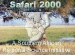 |
Safari 2000 is an international regional science initiative being developed for Southern Africa to explore, study and address linkages between land-atmosphere processes and the relationship of biogenic, pyrogenic or anthrogenic emissions and the consequences of their deposition to the functioning of the biogeophysical and biogeochemical system of southern Afirca. | |
| NASA'S New Millenium Program (NMP) | ||
| The Earth Observing 1 (EO-1) Advanced Land Imager (ALI) and Landsat-7 Enhanced Thematic Mapper Plus (ETM+) data sets covering part of the Kruger National Park on May 30, 2001 are available from the FTP download site. | ||
| NASA Land Processes DAAC (Distributed Active Archive Center) | ||
|
|
Eastablished as part of NASA's Earth Observing System (EOS) Data and Information System (EOSDIS) initiative to process, archive, and distribute land-related data collected by EOS sensors, thereby promoting the interdisciplinary study and understanding of the integrated Earth system. The role of the Land Processes DAAC includes the processing and distribution of ETM+ data acquired by Landsat 7, higher-level processing and distribution of ASTER data, and the distribution of MODIS land products derived from data acquired by the Terra and Aqua satellites | |
| Center for Global Change and Earth Observations | ||
| Through the Center for Global Change and Earth Observations at Michigan State University the Tropical Rain Forest Information Center (TRFIC) pledged to disseminate the Landsat 2000 ETM+, 1990 TM, and 1970 MSS ortho-rectified datasets to African researchers and research programs at the Sixth AfricaGIS Conference held in Dakar, Senegal (November 4 - 7, 2003). | ||
| Tropical Forest Change Assessment | ||
| Tropical Africa 1990-1998
Tropical Forest Information Systems (TFIS) uses low resolution AVHRR,
ATSR, and SPOT Vegetation images
|
||
| Monsoon Circulation Studies | ||
 |
Eltahir and Gong (1996)
Deforestation, Desertification and the Drought in West Africa
|
|
| European Space Agency | ||
 |
Phytoplankton concentration
measured by MERIS
|
|
| Famine Early Warning Systems Network (FEWS NET) | ||
| The Goal of the Famine Early Warning Systems Network (FEWS NET) is to strengthen the abilities of foreign countries and regional organizations to manage risk of food insecurity through the provision of timely and analytical early warning and vulnerability information. | ||
| NASA Landsat Pathfinder - Humid Tropical Deforestation Project | ||
|
|
NASA Landsat
Pathfinder Humid
Tropical Deforestation Project undertaken by the Dept. of Geography at
the Univ. of Maryland, uses data sets from both the Thematic Mapper and
Multispectral Scanner System of Landsat to map deforestation in the
humid tropics during the 1970's, 1980's and 1990's. Data for
Central African Republic and the Democratic Republic of Congo can be downloaded
at this site.
|
|
|
HOME / ENVIRONMENT / STUDIES / SENSORS / REFERENCES Revised: April 29, 2004 . |
||

