|

|
MACRO
29 September, 2005. approximately 14 km by 14 km.
This
is a Proba satellite image of ground-water fed lakes in the Gobi
Desert in Chinas Inner Mongolia.
The lakes are surrounded by some of the tallest dunes in the
world.
Data
downloaded from the European Space Agency. Additional
image processing by S. Young.
|
|
|

|
MICRO
Fall, 2011. Width of
image approximately 5 mm.
Polished
mineral surface. Colorized
scanning electron microscope image.
Imaged
and processed by P. Kelly.
|
|
|

|
MICRO
Fall, 2011. Width of
image approximately 2.5 mm.
Polished
mineral surface. Scanning
electron microscope image.
Imaged
and processed by P. Kelly.
|
|
|

|
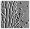
MICRO
Fall, 2011. Width of
image approximately 3 mm.
Polished
aluminum surface. Scanning
electron microscope image.
Imaged
and processed by P. Kelly.
|
|
|

|
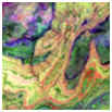
MACRO
13, June, 2001.
Approximately 28 km by 29 km.
This
is an ASTER satellite image of the Atlas mountains of Morocco.
Image
downloaded from NASA's Earth
Observatory web site and processed by S. Young.
|
|
|

|
MACRO
10 August 2001.
Approximately 80 km by 60 km.
This
is a Landsat satellite image from north Africa
Raw
data downloaded from Global Land Cover Facility and processed by S.
Young.
|
|
|

|
MICRO
Fall, 2011. Width of
image approximately 3 mm.
Surface
of the wing of a Blue Darner Dragonfly.
Colorized scanning electron microscope image.
Imaged
and processed by P. Kelly.
|
|
|

|
MICRO
Fall, 2011. Width of
image approximately 300 ΅m.
Skin
of a Leopard Frog. Colorized
scanning electron microscope image.
Imaged
and processed by P. Kelly.
|
|
|

|
MACRO
16 April, 2001.
approximately 15 km by 12 km.
This
digital photograph of deforestation in eastern Bolivia, taken from
the International Space Station.
The image was provided by the Johnson Space Center.
Image
downloaded and cropped by S. Young.
|
|
|

|
MACRO
21 November, 2002.
Approximately 1.5 km by 1 km.
This
is a normal color digital photograph from the International space
station (transformed into a black & white image) of agriculture
in Lake Tandou, NSW, Australia.
Image
from NASA's Earth Observatory
web site and processed by S. Young.
|
|
|

|
MICRO
Fall, 2011. Width of
image approximately 500 ΅m.
Surface
of a rotted human tooth. Colorized
scanning electron microscope image.
Imaged
and processed by P. Kelly.
|
|
|

|
MACRO
4 September, 2010. approximately 10 km by 10 k.
This
natural-color image of the Matusevich Glacier, captured by the
Advanced Land Imager (ALI).
The glacier is found
in East Antarctica.
Original
image: NASA Earth Observatory image created by Jesse Allen and
Robert Simmon, using EO-1 ALI data provided courtesy of NASA EO-1
team. Additional
image processing by S. Young.
|
|
|

|
MICRO
Fall, 2011. Width of
image approximately 300 ΅m.
Emerging
eye of a larval zebrafish. Colorized
scanning electron microscope image.
Imaged
and processed by P. Kelly.
|
|
|

|
MICRO
Fall, 2011. Width of
image approximately 500 ΅m.
Surface
of tongue of a Leopard Frog. Scanning
electron microscope image.
Imaged
and processed by P. Kelly.
|
|
|

|
MACRO
7 August, 2002,
approximately 1100 km by 850 km
This
is a true-color Moderate Resolution Imaging Spectroradiometer (MODIS)
satellite image of cumulus cloud patterns captured over the eastern South
Pacific Ocean,
Image
created by Jacques
Descloitres, MODIS Land Rapid Response Team, NASA/GSFC, additional
image processing, S. Young.
|
|
|

|
MACRO
6 August 2001.
Approximately 60 km by 40 km.
This
is a Landsat satellite image from central Mali.
Raw
data downloaded from Global Land Cover Facility and processed by S.
Young.
|
|
|

|
MACRO
15 November
1999. Approximately 100
km by 70 km.
This
is a Landsat ETM satellite image of the Ganges-Brahmaputra Delta.
An RGB 741 image was created and converted into a black &
white image.
Raw
data downloaded from Global Land Cover Facility and processed by S.
Young.
|
|