|
Remote Sensing Environmental Changes |
||||||
|
Since 1972, remote sensing has provided scientists with an exceptional way to monitor Earth's environment and its natural resources. Yet while there is a wealth of remotely sensed data that covers Africa, only a fraction of the existing data is utilized because it takes time to register the satellite images for analyzing change detection. Multi-temporal data sets are needed to discriminate land cover changes between imaging dates. "Remote Sensing is collecting and interpreting information about the environment and the surface of the earth from a distance, primarily by sensing radiation that is naturally emitted or reflected by the Earth's surface or from the atmosphere, or by sensing signals transmitted from a satellite and reflected back to it" (1). "The environment is life, supporting people and other living things. Environment is widely recognized as a 'pilar' of sustainable development. It provides essential goods and services which contribute to meeting basic human needs, and is essential to human development and quality of life. It provides services to ecosystems, including water catchments which protect freshwater resources, wetlands, riverbank environments, biodiversity habitats and ecologically functioning landscapes. The environment is also a sink of the wastes generated from different human and naturally occurring activities" (2). Changes in climate lead to serious consequences for a number of ecosystems and the economies that rely on such ecosystems, in addition to the human impacts caused by the changes. "Climate change is likely to bring increased frequency and severity of flooding and drought to those areas already experiencing variability in rainfall. Additional concerns are increased risk of desertification in Northern Africa and on the southern border of the Sahel, and reduced availability of freshwater in Southern Africa, resulting in lowered food security and the spread of infectious diseases (notably malaria) to new areas. The islands and low-lying coastal areas of Central and Western Africa are most vulnerable to the sea level rise resulting from climate change. Coral bleaching due to sea temperature rise is the biggest threat to the Western Indian Ocean Islands and to the coasts of the countries of Eastern Africa" (read more...).
|
||||||
|
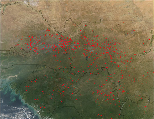
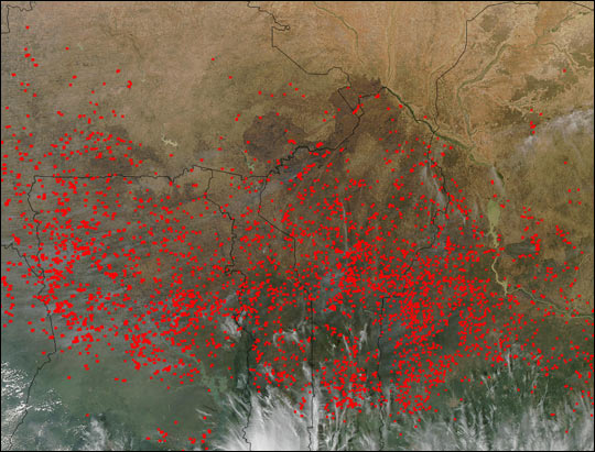
With population growth comes the need for population sustainability. A growing population significantly increases the current demands on local ecosystems, and the consequence of the human activities accompanying such growth further exasperates the conditions that actually support the ecosystem. Human activities such as logging, land clearing, fuel wood collection, cattle ranching, and cash crop plantations are all driven by the needs of populations both locally and globally and are all major contributors to deforestation. In recent decades remotely sensed data has been used to assess, in a preventative approach, changes to the environment whether human induced or the result of natural processes and is now used more efficiently to enforce local policies relative to the assessment and protection of forest land areas. "The Congo Basin, second in size only to the mighty Amazon, loses close to 1.5 million hectares of forest cover every year" (read more...). "Africa has the fastest rate of deforestation in the world. Competing land uses (agriculture and human settlements mainly) are contributing to the decline of forest and woodland areas and the rising demand for fuel wood and charcoal is also a major cause of deforestation. In addition to ecological impacts, local communities are suffering from loss of livelihood and from loss of vital energy sources. Although policies and mechanisms for enhancing sustainable use of forests are in place in many countries and regional cooperative arrangements are well under way, implementation and enforcement of regulations are weak because economic forces are pressurizing governments and communities into unsustainable practices for short-term profits. Political commitment to protection of indigenous forests, sustainable harvesting practices and community ownership needs to be strengthened and development of alternative energy sources is a priority" (read more...).
|
||||||
|
||||||

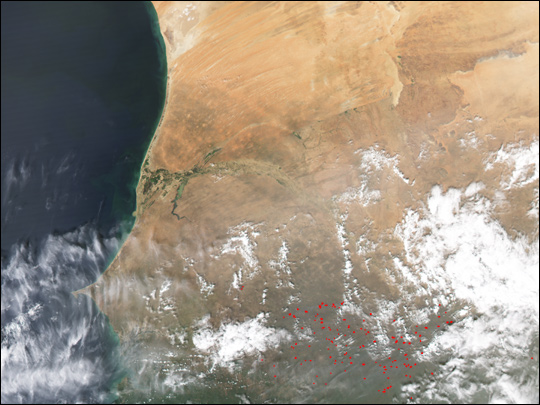
Sept. 19, 2002 South Africa Fires in West Africa, smoke from the agricultural practice of controlled burning |
|
|
|
|||
|
For more information on deforestation in Africa please see: Degradation and Deforestation in Southern Central Africa Africa: Underlying Causes of Deforestation and Forest Degradation |
||||||
|
The process of desertification is quite complex, it is often accelerated by human activities which induce changes to the environment. Activities such as logging, agricultural burning, infrastructure development and other forms of land degradation adversely contribute to this process. A comparison between the 1972; 1984; 1992; and, 2002 Landsat images of Lake Chad clearly demonstrates the process of desertification. As vegetation grows in the former wetland areas, more water is absorbed, and yet less water is being supplied to the area due to the frequency of droughts. Monitoring the Earth's surface with remote sensing makes area analysis much easier to undertake, with larger areas of study making it possible to obtain greater details about the local climate and ecosystems thus providing crucial information for scientists and environmentalists. "Desertification does not occur in linear, easily map-able patterns. Deserts advance erratically, forming patches on their borders. Areas far from natural deserts can degrade quickly to barren soil, rock, or sand through poor land management. The presence of a nearby desert has no direct relationship to desertification. Unfortunately, an area undergoing desertification is brought to public attention only after the process is well underway. Often little or no data are available to indicate the previous state of the ecosystem or the rate of degradation. Scientists still question whether desertification, as a process of global change, is permanent or how and when it can be halted or reversed" (USGS). |
||||||
Landsat 1 image acquired on Dec. 8, 1972 showing Lake Chad about 1/10th its former size since the 1960's
|

Landsat 4 image acquired on Nov. 1984 of Lake Chad showing a significant decrease in the water level since 1972. |

Landsat image acquired on Nov. 1992 of Lake Chad showing further desertification. |
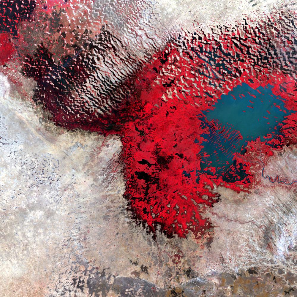
Landsat 7 image acquired on Dec. 18, 2002 of Lake Chad revealing more dunes and less water. |
|||

Bands 7 , 5, and 2 (RGB) were used to create this image of Lake Chad acquired by MERIS, on Sept. 12, 2003. The image shows a higher water level then seen in the Landsat7 2002 image.
|
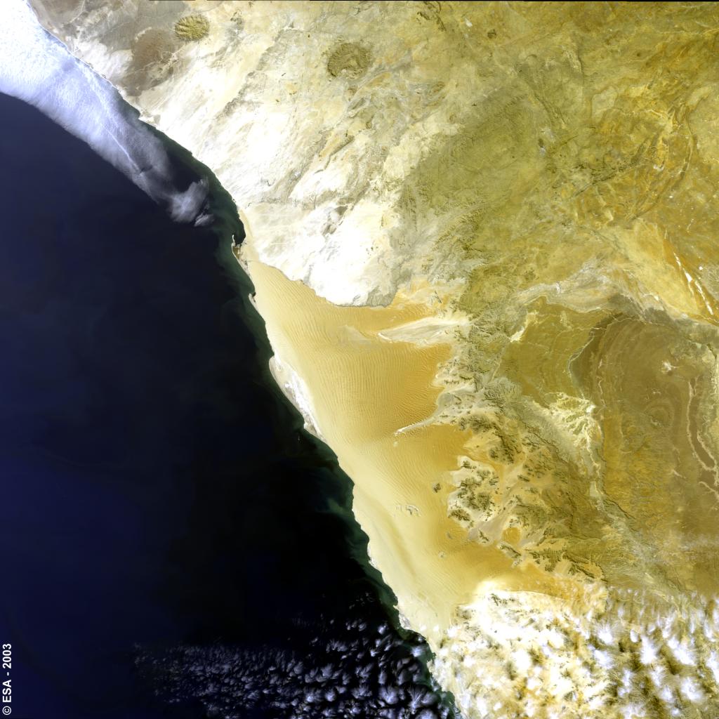
Bands 7, 5, 2 (rgb) were used to create this MERIS image acquired Aug. 22, 2003 which shows sand dunes in the Namibia desert. |
|||||
|
"A Natural Hazard is an unexpected or uncontrollable natural event of unusual magnitude that threatens the activities of people or people themselves" (Natural Harazrds.org).
|
||||||
|
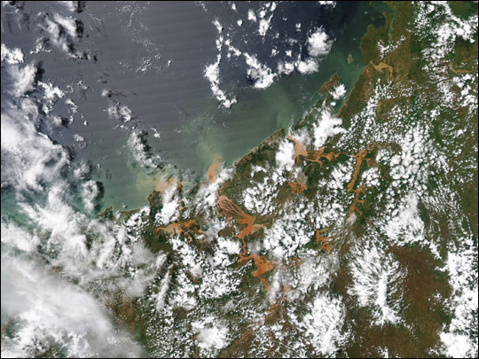
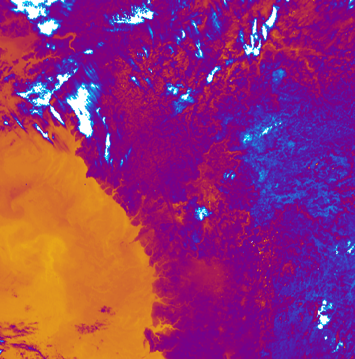
MODIS image acquired on March 6, 2004 showing a dust storm over Central African |
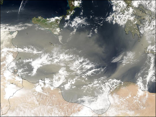
MODIS image acquired on March 27, 2004 showing dust blowing from the Saharan Desert into the Meditteranean. |
|||||
|
||||||
|
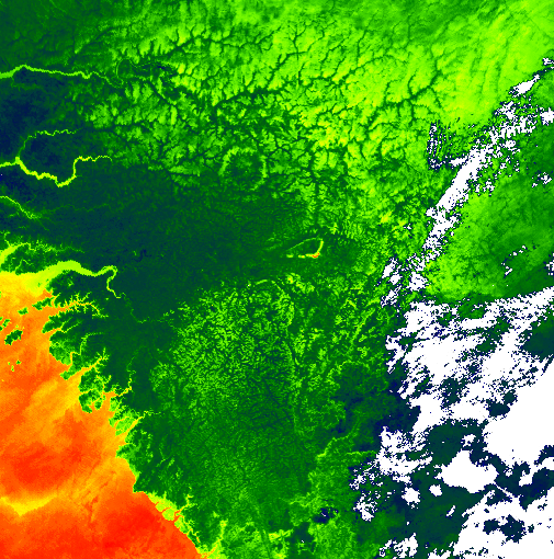
MISR images acquired August, 25, 2000 showing the effect of seasonal floods along the Zambezi River
|
||||||

|
MODIS image of Madagascar March 14, 2004 |
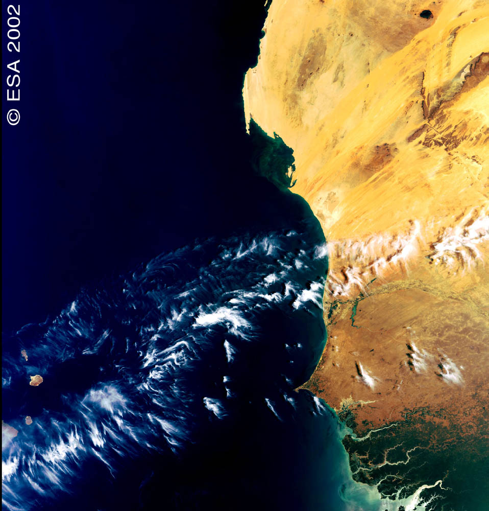
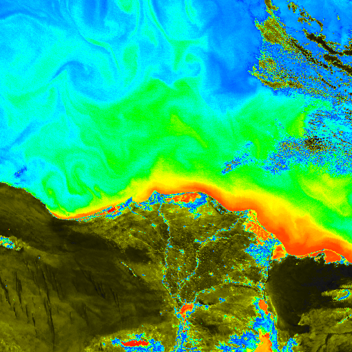
MERIS image of Mauritania acquired March 22, 2002 - shows chlorophyll concentrations off West Coast (phytoplanktons) |
||||
For more information visit USGS - Africa Volcanoes and volcanics |
||||||
|
Stereo anaglyph derived from a SRTM image blended with a Landsat image of Nyiragongo volcano in the Congo which erupted on January 17, 2002 The Landsat image used here was acquired on December 11, 2001, about a month before the eruption. |
SIR-C/X-SAR false color image of Central Africa acquired October 5, 1994 showing radiating lava flows from the Virunga volcano chain dating from the 1950s to the late 1980's. |

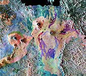
ATSR image of West Africa acquired Jan. 23, 1992 the circular feature is suggestive of a meteorite impact crater. (click here to read more about remote sensing and meteor craters) |
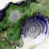
Landsat 7 image acquired January 2001, showing a geological formation in the Maur Adrar Desert in the African country of Mauritania. Although it resembles an impact crater, the Richat Structure formed when a volcanic dome hardened and gradually eroded, exposing the onion-like layers of rock |
|||
|
Urbanization in Africa has been increasing over the last few decades and continues to alter the natural landscape in its path. "The reasons for rapid growth of urban populations include overall high population growth rates, and ‘pull factors’ such as opportunities for employment, education, and improved access to health care which attract people from urban areas. African cities account for 60 per cent of the region’s GDP and are important centres for education, employment, and trade" (UNCHS 2001b). "The colonial influence on development resulted in many of Africa’s urban centres and national capitals being located on the coast, maximizing access to trade, international travel, and development. However, there are also many social challenges associated with urbanization, such as the influx into urban areas of people forced out of rural areas by declining agricultural yields and who come to the urban areas in the hope of employment and greater income security. In many urban areas rates of economic growth and infrastructure development have lagged urbanization rates, resulting in high levels of unemployment, inadequate standards of housing and services, and impacts on human health and development. Environmental disasters and conflicts have also caused many people to flee rural areas and to seek refuge in urban centres. In Mozambique about 4.5 million rural people were displaced to urban areas because of civil strife in the 1980s (Chenje 2000) and the third largest settlement in Sierra Leone is a displaced persons camp" (7) read more....
|
||||||
|
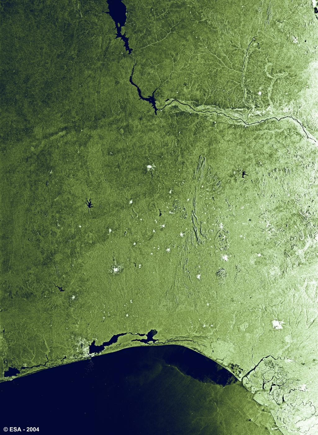
Mosiac of two ASAR images acquired November 11, 2003, showing Benin, Togo and Nigeria. The major Nigerian cities are visible as large bright areas.
|

MERIS image of South Africa acquired July 6, 2002. Visible are the coastal cities of Port Elizabeth and Durban
|

MERIS image of Morocco acquired June 18, 2003. Visible are the Moroccan cities of Tangier, Tétouan and Casablanca
|
||||
|
ATSR image acquired May 9, 1992 showing the Nile Delta in Egypt. Towns are visible as bright blue spots
|

ERS-2 image of Cape Town acquired Aug. 31, 2001, shows the urbanized areas of the Southwestern coast of South Africa.
|

Image of Southern Africa acquired March 1, 1999.
|
|
|||
|
HOME / ENVIRONMENT / STUDIES / SENSORS / REFERENCES Revised: April 29, 2004 . |
||||||


