CZCS
Coastal Zone Color Scanner
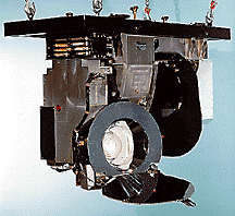
The Coastal Zone Color Scanner (CZCS) was a multi-spectral line scanner devoted principally to measurements of ocean color. During its 7 1/2 year lifetime (Oct. 1978 - June 1986), CZCS acquired nearly 68,000 images, each covering up to 2,000,000 square kilometers of ocean surface.
|
|
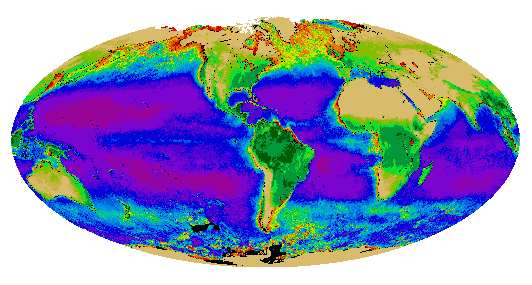
The first truly global view of the Earth's biosphere.
|
|
|
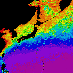
The boundaries of the Gulf Stream off the U.S. East Coast (left) and of the Kuroshio Current off Japan (right) are revealed by the color shift between the low pigment waters of the currents and the higher concentrations in adjacent continental shelf or slope waters. These images were derived from all CZCS data collected between November 1978 - June 1986. Note warm-core rings with low pigment concentration and cold-core with higher pigments along the northern and southern Gulf Stream boundaries, respectively.
|
|
The Coastal Zone Color Scanner Instrument
HOME NASA-TOPEX MODIS SeaWiFS OCTS Seasat