SANDSTORMS
|
|
SANDSTORMS |
|
SENSORS
|
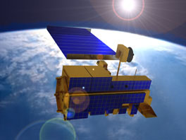
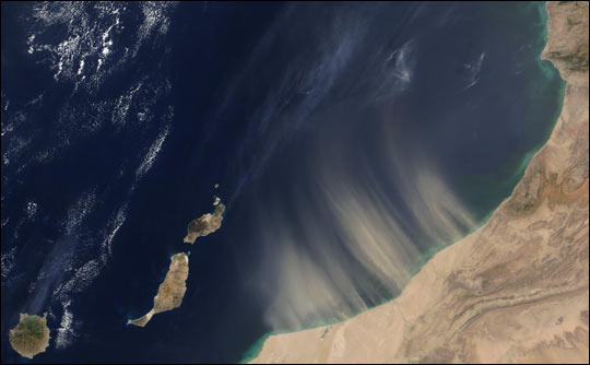
Sandstorms are a natural phenomenon and cannot be completely controlled or eliminated. Early warnings of sand and dust storms are critical to preparedness for these, at times, disastrous events. The accurate and early sandstorm forecast can be attributed to the satellite remote-sensing monitoring technology. Images from meteorological satellites can be send to the ground within several minutes and this greatly helps with the analysis of sandstorm sources, movement and expansion. In remote-sensing sandstorms three main satellites are used Terra,and FY-1C. MODIS (or Moderate Resolution Imaging Spectroradiometer) is a key instrument aboard the Terra satellite and FY -1C is a Meteorological Satellite.
|
|
|
|
|
Terra's orbit around the Earth is timed so that it passes from north to south across the equator in the morning. Terra MODIS is viewing the entire Earth's surface every 1 to 2 days, acquiring data in 36 spectral bands, or groups of wavelengths. These data will improve our understanding of global dynamics and processes occurring on the land, in the oceans, and in the lower atmosphere. MODIS is playing a vital role in the development of validated, global, interactive Earth system models able to predict global change accurately enough to assist policy makers in making sound decisions concerning the protection of our environment. For tracing sandstorms a thermal infrared remote sensing retrieval method developed by Wen and Rose [1994], which retrieves particle sizes, optical depth, and total masses of silicate particles in the volcanic cloud, was applied to an April 07, 2001 sandstorm over northern China, using MODIS. Results indicate that the area of the dust cloud observed was 1.34 million km2, the mean particle radius of the dust was 1.44 µm, and the mean optical depth at 11 µm was 0.79. The mean burden of dust was approximately 4.8 tons/km2 and the main portion of the dust storm on April 07, 2001 contained 6.5 million tons of dust. This demonstrates that Wen and Rose's retrieval method could be successfully applied to past and future sandstorm events using IR channels of AVHRR, GOES or MODIS. (The preceding information was obtained at http://www.agu.org/pubs/crossref/2003/2003GL017405.shtml) |
|
|
|
|
|
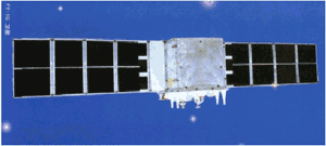
The FY-1C is an operational polar orbiting meteorological satellite of China. It is hoped that more products can be generated and can be used in the operational weather forecasting in China. China is ready to share these data with the world meteorological community, to contribute to the World Weather Watch Program and World Climate Research Program. The satellite is placed in a sun-synchronous orbit at an altitude of 862.8 km with an inclination of 98.8°, an eccentricity of 0.009, at descending local time of 08:34 and with a period of 102.23 min. The main missions of FY-1C satellite includes:
|
|