|
Home New Zealand Remote Sensing Programs Satellite Images Links
|
|||||

The Olgas, Northern Territory, Australia (click for enlargment)
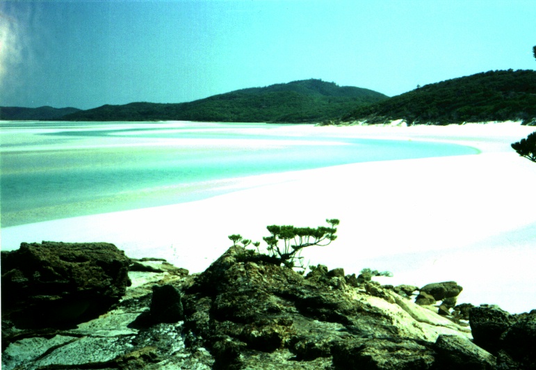
Whitehaven Beach, Queensland, Australia (click for enlargment)
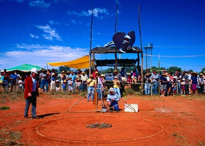
Queensland Toad Racing
Koala Bear (click for link to wildlife images) |
Australia became a commonwealth of the British Empire in 1901. It was able to take advantage of its natural resources to rapidly develop its agricultural and manufacturing industries and to make a major contribution to the British effort in World Wars I and II. Long-term concerns include pollution, particularly depletion of the ozone layer, and management and conservation of coastal areas, especially the Great Barrier Reef. A referendum to change Australia's status, from a commonwealth headed by the British monarch to a republic, was defeated in 1999. The CIA World Fact Book, Australia: http://www.odci.gov/cia/publications/factbook/geos/as.html Location: Oceania, continent between the Indian Ocean and the South Pacific Ocean Area:
total:
7,686,850 sq km Climate: Generally arid to semiarid; temperate in south and east; tropical in north Terrain: Mostly low plateau with deserts; fertile plain in southeast Elevation extremes:
lowest point:
Lake Eyre -15 m Geography note: World's smallest continent but sixth-largest country; population concentrated along the eastern and southeastern coasts; regular, tropical, invigorating, sea breeze known as "the Doctor" occurs along the west coast in the summer. Population: 19,731,984 (July 2003 est.) Life expectancy at birth:
total population: 80.13 years Nationality: noun: Australian(s) Ethnic groups: Caucasian 92%, Asian 7%, aboriginal and other 1% Religions: Anglican 26.1%, Roman Catholic 26%, other Christian 24.3%, non-Christian 11%, other 12.6% Languages: English, native languages Government type: Democratic, federal-state system recognizing the British monarch as sovereign. Capital: Canberra Independence: January 1, 1901 (federation of UK colonies) National holiday: Australia Day, 26 January (1788) Flag description: Blue with the flag of the UK in the upper hoist-side quadrant and a large seven-pointed star in the lower hoist-side quadrant known as the Commonwealth Star, representing the federation of the colonies of Australia in 1901; the star depicts one point for each of the six original states and one representing all of Australia's internal and external territories; the remaining half is a representation of the Southern Cross constellation in white with one small five-pointed star and four larger, seven-pointed stars. GDP: purchasing power parity - $525.5 billion (2002 est.) Industries: Mining, industrial and transportation equipment, food processing, chemicals, steel.
Additional links and information from this page comes from: The Lonely Planet Guide to Australia: (this site has everything) http://www.lonelyplanet.com/destinations/australasia/australia/index.htm Guide to Australia: (lots of links) http://www.csu.edu.au/australia/ The Embassy Of Australia, Washington D.C.: (some good quick data and pictures as well as information for students planning to study there) http://www.austemb.org/ Australia Images and Music: (national anthem and other national songs, great images) http://www.imagesaustralia.com/
New Zealand Remote Sensing Programs Satellites Images Links
|
Maps courtesy of: http://www.virtualaustralia.com/maps/elevation.shtml |
|||


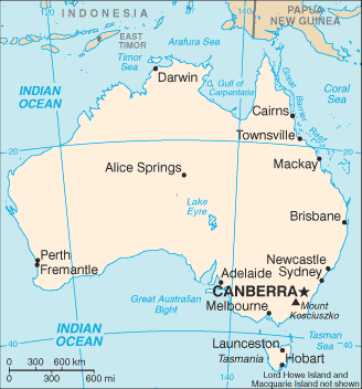
 Elevation Map
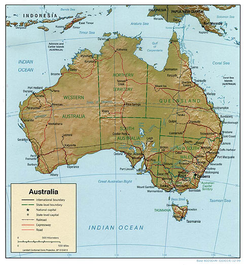 Relief Map