| IMAGERY | |||||||||||||||||||||||||||||||||||||||||||||
Imagery |
|
||||||||||||||||||||||||||||||||||||||||||||


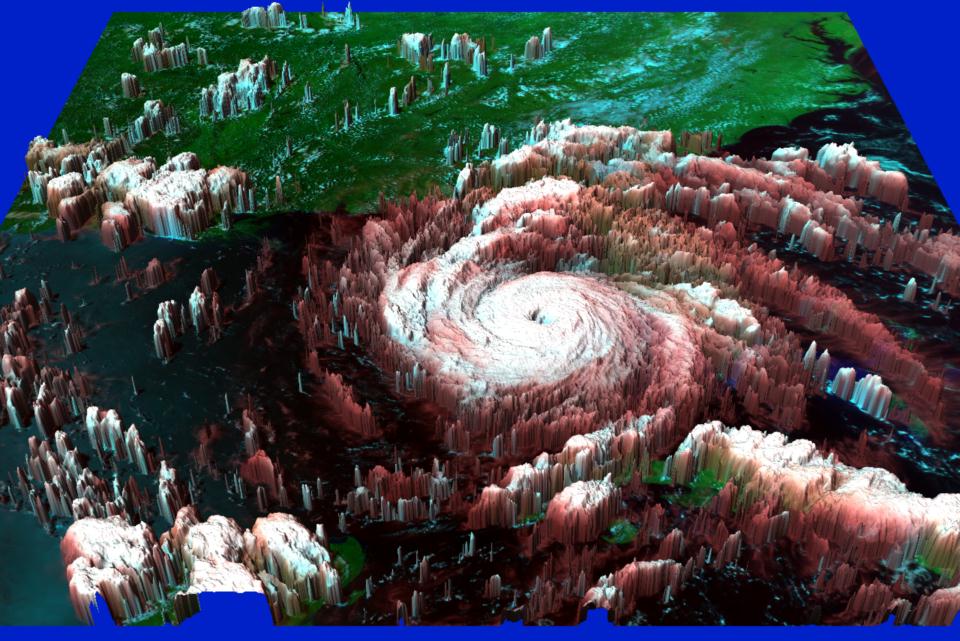
![[Floyd 1999/09/14]](http://rsd.gsfc.nasa.gov/rsd/images/Floyd/Floyd_19990914_1259_md.jpg) 1999 September 14, 12:59 UT
1999 September 14, 12:59 UT![[Floyd 1999/09/15]](http://rsd.gsfc.nasa.gov/rsd/images/Floyd/Floyd_19990915_2015_md.jpg) 1999 September 15, 2015 UT
1999 September 15, 2015 UT![[Floyd 1999/09/16]](http://rsd.gsfc.nasa.gov/rsd/images/Floyd/Floyd_19990916_1215_md.jpg) 1999 September 16, 1215 UT
1999 September 16, 1215 UT![[Floyd full-earth 1999/09/16]](http://rsd.gsfc.nasa.gov/rsd/images/Floyd/Floyd_full_earth_19990916_1445_md.jpg) 1999 September 16, 1445 UT
1999 September 16, 1445 UT![[Floyd 1999/09/14]](http://rsd.gsfc.nasa.gov/rsd/images/Floyd/Floyd_19990914_1430_md.jpg)
![[Floyd 1999/09]](http://rsd.gsfc.nasa.gov/rsd/images/Floyd/990914_1259_newsweek300.jpg) Image printed in Newsweek
Image printed in Newsweek
 |
 |
 |
"The top image from NOAA-7shows the hurricane as it strikes land in Florida, with colorized tones representing higher intensities. In the middle is a GOES-7 full-Earth, color view obtained on August 25, 1992, in which Andrew approaches New Orleans. This perspective indicates scale, showing the hurricane, while powerful as organized, was still just another mass of clouds of no greater extent than some other storm systems. But, on close-up (bottom) in the AVHRR color version (RGB = 0.9; 1.5R; 3.5 µm), the perfection of the eye and the well-developed structure of this counterclockwise-spinning low-pressure system are obvious".- Taken from Applications of Remote Sensing