|
|
||||||||||||||||||
|
Sensors and
Satellites
|
GEOSTATIONARY OPERATIONAL ENVIRONMENTAL SATELLITES
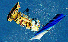
This is an artist's rendition of the GOES satellite
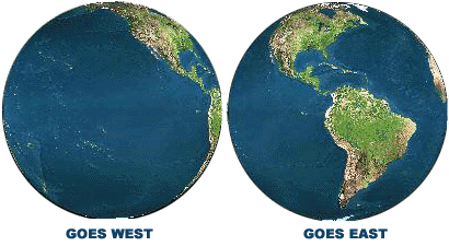
"GOES satellites provide the kind of continuous monitoring necessary for intensive data analysis. They circle the Earth in a geosynchronous orbit, which means they orbit the equatorial plane of the Earth at a speed matching the Earth's rotation. This allows them to hover continuously over one position on the surface. The geosynchronous plane is about 35,800 km (22,300 miles) above the Earth, high enough to allow the satellites a full-disc view of the Earth. Because they stay above a fixed spot on the surface, they provide a constant vigil for the atmospheric "triggers" for severe weather conditions such as tornadoes, flash floods, hail storms, and hurricanes. When these conditions develop the GOES satellites are able to monitor storm development and track their movements. GOES satellite imagery is also used to estimate rainfall during the thunderstorms and hurricanes for flash flood warnings, as well as estimates snowfall accumulations and overall extent of snow cover. Such data help meteorologists issue winter storm warnings and spring snow melt advisories. Satellite sensors also detect ice fields and map the movements of sea and lake ice." (For more Info on this topic)
This is an aritst's rendition of the POES satellite
"POES satellites include: Defense Meteorological Satellite Program (DMSP), Landsat, SPOT and NOAA Polar-orbiting Operational Environmental Satellites (NPOES). The DMSP and NPOES satellites are operational meteorological satellites. Imagery from successive orbits overlay each other, providing global daily coverage from each satellite. Commercial polar orbiters like Landsat and SPOT, on the other hand, are intended for geophysical remote sensing, with an emphasis on high-resolution and multispectral imagery, at the cost of daily global coverage."(For more info on this topic)
TIR and ALTIMETRY SENSORS "Scientists rely on TIR and altimetry remote sensing to supply data for use in hurricane and climate prediction. There are several sensors which provide TIR images. However, the AVHRR sensor aboard the NOAA Polar Orbiting Environmental Satellites (POES) has been the prominent instrument used to find SST for several reasons. Although it was originally designed for meteorological applications, scientist realized AVHRR's potential for finding SST soon after the first one was launched in the early 1980's. There is a consistent record of SST from the AVHRR sensors for a relatively long amount of time, obviously a very important resource for climate modelling. An algorithm computes SST using the three TIR bands coupled with measurements from a series of satellite tracked ocean buoys". (For more info on this topic)
Types of TIR and ALTIMETRY SENSORS
ATSR- Along track scanning radiometers
Imagery taken from Modis MODIS- Moderate Resolution Imaging Spectrometer
This is an artist' s rendition of the TERRA satellite TERRA (EOS)- Earth Observing System
AVHRR- Advanced Very High Resolution Radiometer
This is an artist's rendition of the TOPEX satellite TOPEX/POSEIDON- Ocean Topography Experiment
This is an picture of the ERS satellite ERS- European Remote Sensing Satellites
|
|||||||||||||||||