GeoEye-1
Home | Terahertz (THz) Wave Technology | GeoEye-1
| WorldView-1 | WorldView-2
| Quickbird | IKONOS
The
GeoEye-1 satellite was launched on September 8, 2006 and features the most
sophisticated technology ever used in commercial remote sensing. It has the capability to locate an object
within three meters of its actual location and can collect over 350,000 square kilometers
of multispectral satellite imagery every day.
The satellite can also capture 700,000 square kilometers in panchromatic
every day. To put this into prospective,
the panchromatic area is roughly the size of Texas and the multispectral area
is about the size of New Mexico. It can acquire
data at 0.41 meter resolution in panchromatic and 1.65 meter resolution in
multispectral.
The
operation life of this satellite was designed for 7+ years with enough fuel for
15 years. It orbits the Earth at 425
miles above the surface at a speed of 17,000 miles an hour with a
sun-synchronous orbital type. It crosses
the equator at 10:30 AM every day.
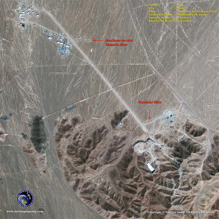
This 0.5-meter satellite image of a uranium enrichment
plant located in Qom, Iran, was captured by the GeoEye-1 satellite sensor. It
clearly depicts a Surface-to-Air Missile (SAM) site, as well as a nuclear site,
as they appeared on September 26, 2009.
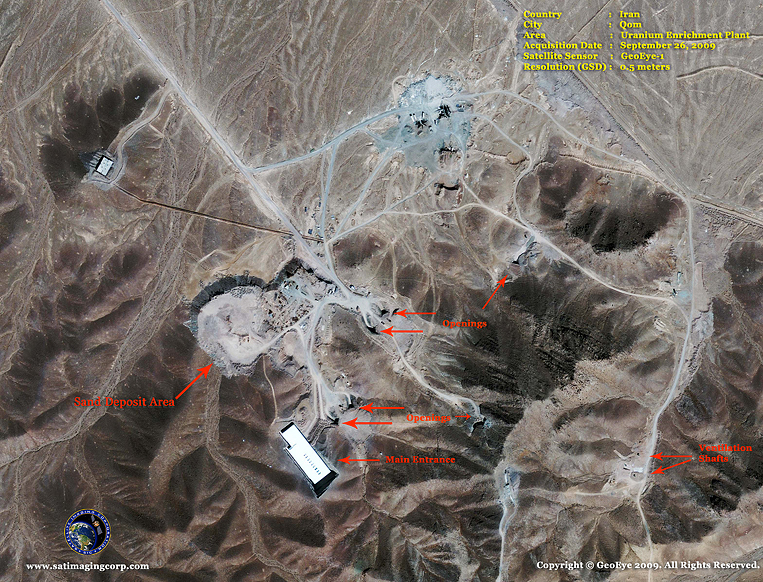
This 0.5-meter satellite image of a uranium enrichment
plant in Qom, Iran, was captured by the GeoEye-1 satellite sensor on September
26, 2009.