Quickbird
Home | Terahertz (THz) Wave Technology | GeoEye-1
| WorldView-1 | WorldView-2
| Quickbird | IKONOS
The
Quickbird satellite was launched on October
18, 2001 from Vandenberg Air Force Base in California. It uses the state-of-the-art BGIS 2000 multispectral sensor and collects data with 0.61 meter
resolution. It orbits the Earth at 450 kilometers at
25,560 kilometers an hour. Its orbit
period is 93.5 minutes and has between a 1 to 3.5 day revisit time, depending on certain parameters. It is one of the older satellites used for
Homeland Security but still very effective.
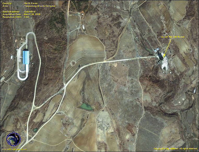
This 0.6m QuickBird satellite
image depicts the North Korean Taepodong missile
complex, which became the focus of international scrutiny after a recent rocket
firing incident.
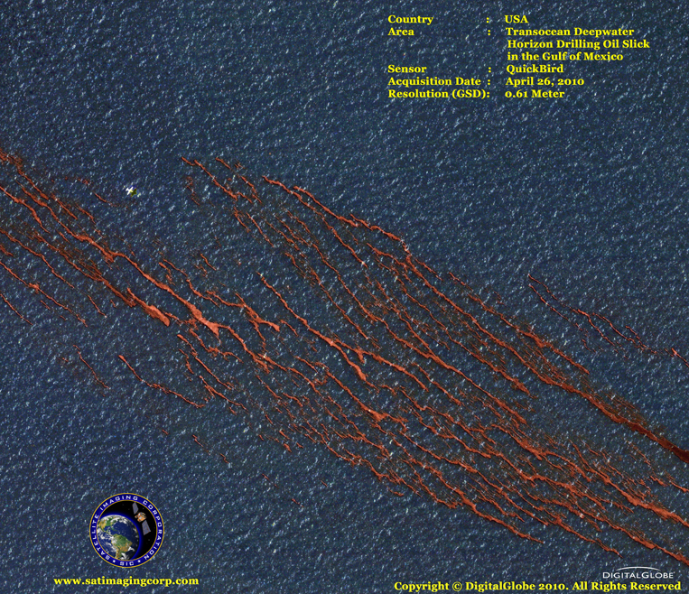
This QuickBird satellite image
depicts an oil slick in the Gulf of Mexico caused by the sinking of Deepwater
Horizon, a semi-submersible rig whose purpose was to drill oil
wells in extremely deep water.