| Remote Sensing for Wind Power Generation | ||
| INTRODUCTION Siting Wind Turbines Remote Sensing OVER SEA OVER LAND ON SITE WIND POWER
Web site created
by E-mail comments and suggestions to pmkelly@prodigy.net. Last updated 4/24/2002.
|
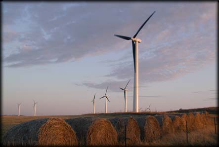
The feasibility of large-scale production of electric power from wind has also increased dramatically in the past thirty years. Wind turbines are larger and more efficient, meaning that power can be produced at more competitive prices. And governments are increasingly looking to renewable resources, such as wind, to reduce carbon emissions and other pollution from burning fossil fuels. Remote sensing technologies are just beginning to be applied to wind power planning. But what about the future? This web site brings together web resources on both the remote sensing of winds and the siting needs of wind power generation. We ask whether remote sensing might eventually improve the siting of wind farms by providing cheaper, more accurate, detailed, historical and real-time information. Data for Siting
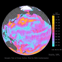
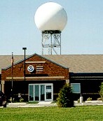
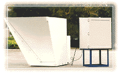
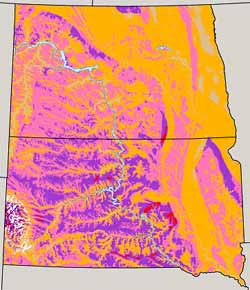
Wind Turbines Fifteen years ago, wind estimates and power generation projections depended upon anemometer data and other field observations. For regional overviews, wind assessments and atlases were created from historical weather station data. When evaluating a particular site, a wind power developer would erect a tall mast and take detailed wind readings on-site for a period of three months to more than a year. Wind atlases and site studies are still needed, but beginning about five years ago, remote sensing technologies began to be applied to both steps in the siting process. Remote Sensing for Wind In many fields, remote sensing has been able to give more complete coverage, over both time and space, than point-specific field measurements. It appears that remote sensing is beginning to make this contribution to wind energy development as well. |
|